|
||
| HOME | STARCHARTS | CONSTELLATIONS | OBSERVING | E-SHOP | COURSES | FREE DOWNLOADS | ABOUT | LINKS | ||
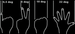
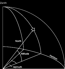
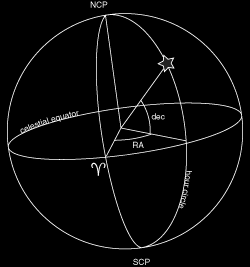
Astronomy Coordinate SystemsIt is helpful (though incorrect) to imagine all the stars to be fixed onto the inside of a vast crystalline dome - the celestial sphere.
|
||||||||||||
| Page last modified on
2004-11-09
|
||